
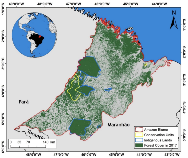
The latest publication from Dr. Ozeas Costa – an associate professor in the School of Earth Sciences based at the Mansfield Campus – is the result of a multi-institutional collaboration that took eight years to develop. This work used remote sensing datasets and analysis to (1) identify the levels of forest fragmentation between 1985 and 2017 in the eastern Amazon rainforest (the 25,000 km2 of forest that remains within the Maranhão State), (2) map the occurrence of forest fires in the region between 2003 and 2017, and (3) investigate the relationship between forest fragmentation and fires during this period. The dataset was collected and analyzed in 2020. The work has just been published in the journal Fire(https://doi.org/10.3390/fire5030077).
Brazil holds the largest continuous area of forest in the Amazon region, encompassing about 60% of the Amazon basin, distributed over nine federative units. One of these units, the state of Maranhão, is part of the Belém Endemism Center, where about thirty species of animals and plants are on the endangered species list. The state – which lies along the “arc of deforestation”, comprising the eastern and southern flanks of the Brazilian Amazon – had an original old-growth forest cover of 110,400 km² (about 33% of the state's territory). Large-scale deforestation since the mid-1960s – primarily for agriculture and cattle ranching – has resulted in the loss of a significant portion of the original forest cover in the Maranhão Amazon, and only about 24% of the original old-growth forest cover remained in 2019.
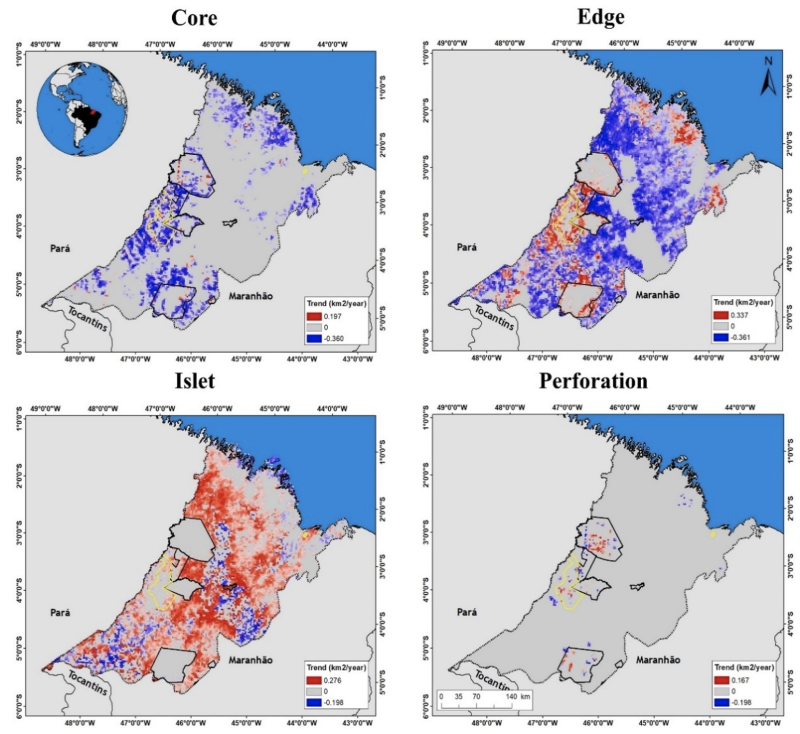
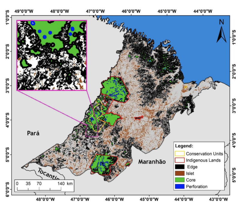
Although only 28% of the area mapped in the Brazilian Amazon in 2014 was classified as “fragmented”, the state of Maranhão has the second-highest level of forest fragmentation among all states in the Brazilian Amazon, with almost 74% of the forest area in the state being represented in the fragmented categories (edge, islet, perforation). Although fire dynamics are well-documented in other biomes in the state, little is known about the relationship between forest fires and forest fragmentation in the Maranhão Amazon. This work shows a 35% decrease in forest cover in the study area, from 88,195 km2 in 1985 to 56,893 km2 in 2017. More than half of the forest cover during this period (65%) corresponded to forest edges (one of the fragmentation categories), and only about 21% corresponded to core forests. In addition, the area of forest islets (another fragmentation category) increased from 3,455 km2 in 1985 to 11,715 km2 in 2017 (a 239% increase), with a significant positive trend of 270 km2 per year.
About 262,205 active fires were recorded in the study area between 2012 and 2017, with an annual average of 43,701 ± 21,763 fires per year. These fires showed a well-defined temporal pattern, with a lower fire activity between January and July (wet season) and a higher activity between August and December (dry season). The lowest average number of active fires within forested areas was observed in March (8 fires per month), while the maximum number of active fires was observed in December (7,024 fires per month). Fires on forested areas accounted for more than half (53%) of all active fires registered in the region during the study period.
Areas in the edge fragmentation category experienced the greatest extent of burned area. About 1,031 km2 on average of forest edges burned per year in the region between 2003 and 2017, the equivalent to 61% of the total burned forest in the study. The second fragmentation class with the greatest extent of forest fires was the islet, with an annual average of 466 km2 per year burned in the same period, the equivalent to 31% of the total burned forest. About 169 km2 on average of forest core burned annually during the study period (about 7%).